Sources for Geodata Mining

FLOOD FORECASTING SYSTEM TOOLS
May 2, 2018
Watershed Monitoring by GIS
May 8, 2018
Geodata Mining
To talk about geodata mining, we first of all need to explain what geodata mining is. In general, data mining is the automated process which provides us with extra data and information from primary data through algorithms and other methods. Data mining is the key process to discover patterns and relationships between several data in order to make better decisions, evolving science and develop successful companies. More specific, this method is used to spot sale trends, predict customer devotion, develop better marketing campaigns, etc. Geodata mining now is the same process referred only to spatial data, or generally, data which are going to be related to the location they belong, in GIS. On the sector of spatial analysis, geodata mining helps us find for example, what is the relation between the concentration of water in the soil and the permeability of this specific type of soil. In this way, we can extract data such as the amount of water which will penetrate to the aquifer, what amount of water need the plants above the soil etc. Moreover, geodata placed in a database in GIS can be detected and correlated with other geodata, by specialized algorithms, for more efficient data analysis. Geodata mining is a very useful “tool” to estimate, predict, and prevent unwanted phenomena.
The main steps of the geodata mining process.
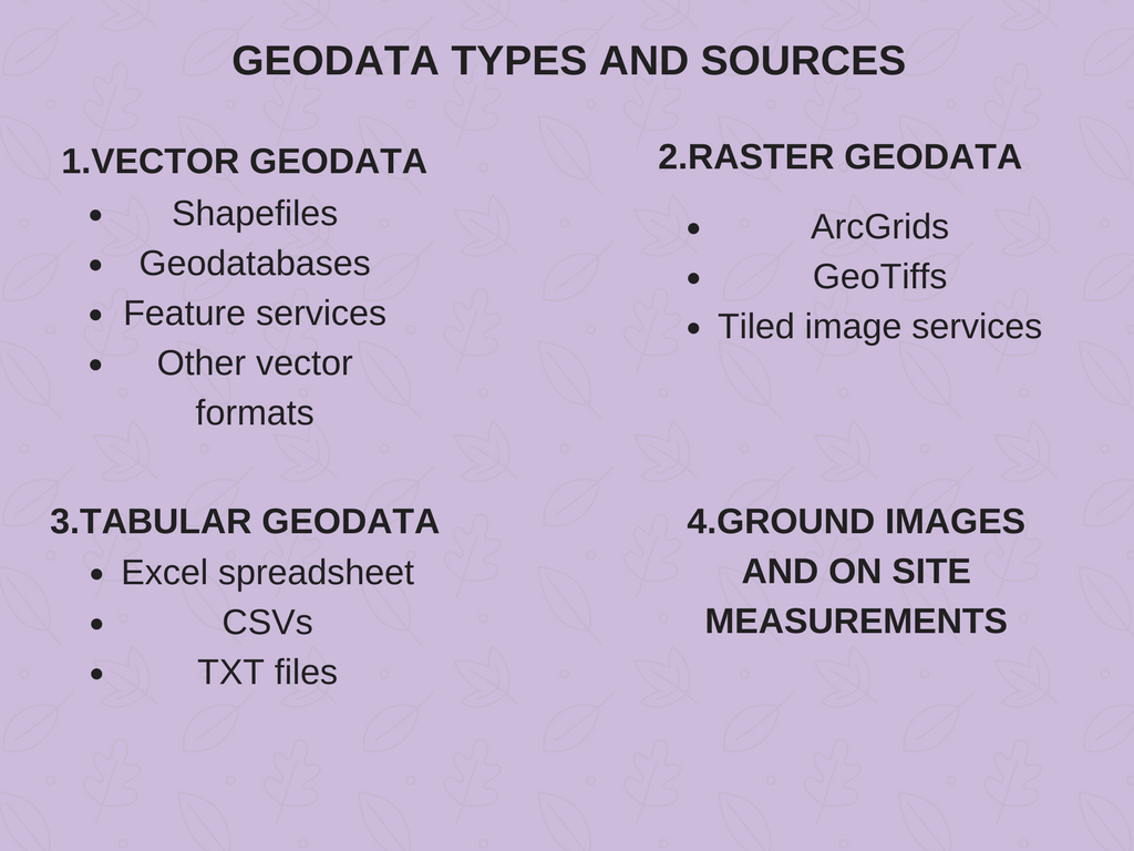
Types of geodata depending on the sources obtained from
Coming to the point it is useful to mention that the process of geodata mining is divided into five main operations as shown below:
-
Geodata collection
-
Preprocessing
-
Transformation
-
Main geodata mining
-
Interpretation/ Evaluation
All the above steps are very important and must be followed exactly in order to facilitate ourselves and to make the process right. Below in this article, we are going to analyze only the first action which is referred to the sources where we collect our primary geodata from.
Geodata capturing- the main source for geodata mining
Geodata capturing is the procedure of inserting data in a GIS system. The problem is that data sometimes is in a conventional format and we need to digitize it. The method of data capturing has this capability, with tools and methods which make digitizing easier; Scanners, GPS, mobiles etc. are some of the tools which make data capturing easier. However, on the field of geodata mining, geodata capturing has the meaning of the source which provides GIS with digitized geodata. On the other hand, data capturing has other “primary” sources to find geodata either already digitized, or conventional.
The coordinate system as a source for geodata mining
All around the world, the coordinate system is the common language for GIS scientists. Global Positioning System (GPS), is the unique mechanism which takes on-site measurements and gives us already digitized coordinates in a geodatabase. Coordinates are all over the world and through them, we can have a deep geodata mining with patterns and relations with every kind of data. We can only imagine that the creation of the equator and the meridians is maybe the earliest discovery of geodata mining through coordinates.
Open source applications for geodata mining.
WebGIS and all the open source applications are a great discovery and a great tool to share data and exploit all the advantages of data gathered on other platforms. In this way geodata mining becomes easier, the amount of geodata is increasing and the patterns become more thorough. In open source platforms, we can find a big variety of geodata and we can use them either on WebGIS or in desktop GIS using all the necessary extensions.
Geodata mining by other on-site measurements
There are several instruments and monitors, which help us take measurements either conventional or digital and through data capturing method to insert them in a geodatabase in GIS. We can have data about atmosphere, soil, water, aquifer, plants and many others, always related to a specific location. Some of these instruments could be anemometer, thermometer, hygrometer, theodolite etc., while some techniques to gather data could be sampling and analytical methods in laboratories and installed stations for monitoring environment and gathering related data.
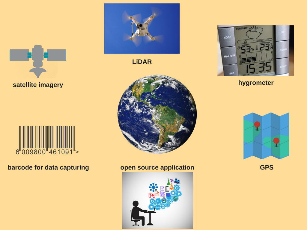
The depiction of the several sources for geodata mining.
Remote sensing sources for geodata mining
Remote sensing is maybe the most basic and obvious method to collect data about the environment and spatial analysis for geodata mining. Including photogrammetry, Lidar, satellite imagery and other actions we can have a complete and huge geodatabase with geodata related to every sector of environment monitoring from water quality to fire spread and earthquake estimation.
After all these, it is obvious that the sources where we collect geodata are the primary and the most important step for a complete survey and the proper development of the process of geodata mining. It is very important to find updated and accurate data to discover the correct patterns between geodata and establish new rules about the science which govern environmental monitoring. Only in that way, we can protect our health and our planet and obviously GIS led us to that road.
For more information about geodata mining through GIS and remote sensing techniques, you can reach us at +49-30-20679130 or visit our UIZ webpage.


