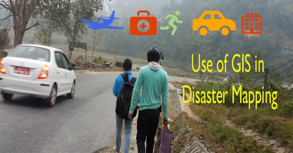
Use of GIS in Disaster Mapping

River Monitoring Challenges
April 7, 2020
Use of Mobile Survey Apps in Forestry
April 23, 2020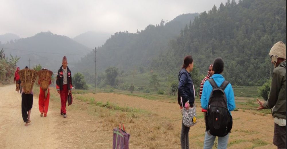
A Geographical Information System means software that is designed to capture, store, check and display the spatial data. GIS is a data management tool helpful also to understand and identify natural hazards or disasters. A disaster indicates an exceptional event that causes harm to many people in many ways. Disaster events may be earthquakes, floods, windstorms, plane crashes, fires and so on. GIS is used in a very broad area. The use of GIS in disaster mapping is one of the effective ways to monitor and mitigate the damage to the devastated area. GIS helps to analyze the information stored and to transmit the information on the geographical region so that the necessary steps can be taken for disaster management. GIS uses satellite images and aerial photographs for searching and rescuing operations.
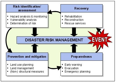
GIS based disaster management
Main uses of GIS in Disaster Mapping
The use of GIS in disaster mapping includes informing the policyholders about disaster events. The use of GIS in disaster mapping helps the administrators to widen their area of intervention and to cooperate with people in the case of disaster. Only a limited number of people has the ability and the knowledge to deal with the complex problems created by a disaster
- >
- GIS in disaster mapping helps to find the areas with the highest concentration of disaster events like floods, landslides, earthquakes, hurricanes, windstorms, wildfires, chemical releases etc.
- It forecasts the extent of the territories affected by disaster events. It specifies the assets which are exposed to actual hazards. It reviews and alters the policy value to minimize disaster events.
- The areas susceptible to disasters are analyzed on the basis of past and present geographical or spatial data thus giving help to the population in the moment of need.
- GIS helps to instruct and provide services like alternative roadways if they are blocked or damaged, connections of power lines and communications, observation of damaged buildings and other physical hazards.
- The use of GIS in disaster mapping cooperates with people by helping them to minimize the effects of disaster events and predicting the upcoming ones. The use of GIS in disaster mapping encourages intelligence to quickly respond in order to minimize the effects of a disaster event.
- It is extended to remote places where people are informed with mobile and wireless services. The use of GIS in disaster mapping creates a perfect 3D network scientific data model.
- With the help of the Online Disaster Response Community (ODRC), communities get to know about disasters and are encouraged to participate in disaster relief programs. Actually, people use sensors which can detect and respond to disaster events. ODRC is becoming very important due to the development of GIS.
- Internet GIS is becoming very popular to reduce disaster events.
- The use of GIS in disaster mapping has helped people to be informed and warned about disaster events. It encourages people to do future research in disaster events.
Due to the cooperation of remote sensing with GIS, it is easy to manage disaster events. Mapping is the preliminary method to know the significant features of the surfaces of the Earth. But GIS is more than mere mapping. The use of GIS in disaster mapping aids many sectors to reduce the disaster effects.
We will also test the applications and maps that we create for you, just to make sure that you get what you expected. But guess what? You don’t have to worry about the security of the data. Leave that on us!
GIS in Disaster Mapping in Nepal
GIS is also working in many fields in Nepal. GIS helps in the identification of the area of landslides, floods and earthquakes. It then provides the necessary steps to overcome the problem. One of the major tasks solved by this technique is the hazard of the earthquake which took place on 25th April, 2015. It was the most unfortunate day for Nepalese people because a terrible earthquake of 7.8 magnitudes hit the land of Nepal. Many lives were lost and many infrastructures were destroyed with the loss of many houses and properties of Nepalese people. In those times GIS was active to find the people in devastated areas, relieving many people. Recently, GIS in disaster mapping has been working to know the causes of earthquakes and is helping to increase relief programs to the people in the affected areas. In Nepal, the use of GIS in disaster mapping has helped people to know humanitarian snapshots, shelter cluster activity, wash cluster activity etc.

Therefore, GIS allows identifying and implementing the emergence programs in many disastrous events. The use of GIS in disaster mapping is being advanced with the help of the latest technologies. So, in the future, the use of GIS in disaster mapping will help to reveal many facts about disaster events. Thus, GIS is a reliable, precise and economic technique for observing accurate data useful for resource management. It is an efficient way to display the information about the resources.
Get in touch with us!
If you think that we are what you are looking for, don’t hesitate to contact us! We will make sure that you will get the maximum support in the challenge you are facing, from the best professional team!


