Utility of GIS System in Spatial Analysis

Water Resource Mapping – Methods
November 11, 2017
Use of Digital Elevation Model (DEM) in GIS
December 2, 2017
Why is GIS System Useful?
GIS system gives us the opportunity to store, edit and analyze data, visualize them and draw conclusions. The abbreviation of GIS means geographic information system and belongs in the wider domain of geoinformatics. GIS system became so important in spatial science evolution as it has the ability to combine location with other information and store data, edit, analyze them, and finally integrate them in visualized maps. GIS system gives us the opportunity, to understand what belongs where and have a better eye on the world and in decision making, as a spreadsheet of data is usually hard to get understood.
Techniques on GIS Systems for Spatial Analyses
Spatial analysis is referred to in the science which studies terrain entities, using topological, geometric or geographic properties and creating techniques and methods with different analytic approaches to create new perspectives on that field.
GIS system is the most important “tool” for spatial analysis as it combines services and techniques to fully understand how the terrain is and the processes take place on it. However, we should be vigilant, as both fields of Spatial Analysis and GIS are increasing rapidly, there are always new products with more analytical tools and more facilities. Some of them will be described below.
1. Slope and Aspect
As it is known, GIS system works with coordinates. Latitudes, longitudes and elevation. The slope in this field represents terrain elevation with the z coordinate measured in degrees or as a percentage. On the other hand, aspect is the direction of slope regarding the north and it is also measured in degrees. Both parameters together with surface curvature demand spatial resolution in order to get calculated using elevation values of each cell.
Skidmore and Jones, authors created a formula to calculate the direction of aspect and slope, which later would be the starting point to represent the above parameters on GIS system. The formulas were:
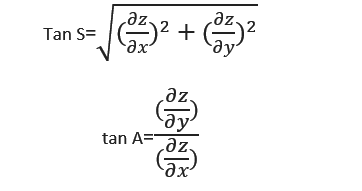
Formula of slope
Where ∂z/∂x and ∂z/∂y are the components of tangents which pass through the elevation point in east-west and north-south direction, while x and y directions should be equal to the surface partial derivatives of the gradient.
2. Data Analysis
Data analysis gives us the opportunity to relate unrelated data. This means that using this method we can create a map with unrelated data which will be related on the map with a logic sequence. For example, imagine that we have data about rainfall density in a large area. Visualizing those data, we can calculate the water power potential according to the rainfall density at specific points. Then with GIS system we can depict the results of our calculations on the map and predict the water power potential between the points. Further, we will find terrain slope, predict the flow of surface runoff through GIS algorithms and take a decision about flood defence project.
Of course, this example is one of many. It is easily understood that GIS system and data analysis technique gives us many opportunities to relate data, predict them if we don’t have enough, depict them on a map and draw conclusions.
3. Topological Modeling
Through the GIS system and topological modelling, it is easy to discover existing relationships between spatial data and locations. In other words, we can identify spots (church, school, hospital etc.) or geographic frames (lake, forest, mountain etc.) and indicate their relationship which could be adjacency, the distance between them, containment etc.
Geometric network
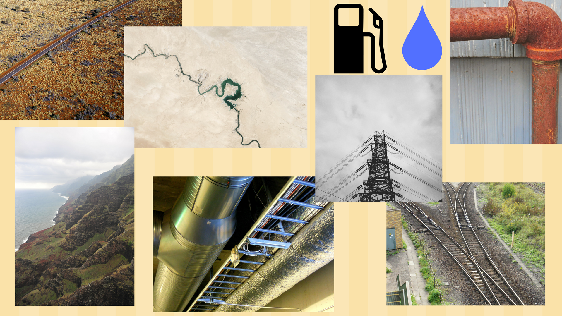
4. Geometric Networks
This tool has the capacity to model linear objects such as hydrology, railway, gas and water network and to find their junction points, interconnections etc. Through GIS system we have the opportunity to visualize and predict for example water flow and to take decisions about the size of the pipes, the slope in which they should be placed and other features.
5. Hydrological Modeling
As it is indicated by its name, this tool is suitable to model and analyze hydrological parameters. On the section of “data analysis”, it was mentioned that in order to find the surface runoff we have to find terrain slope. So, this job can be done with the contribution of hydrological modelling, creating a Digital Elevation Modeling (DEM) which shows slope and aspect of ground in the whole catchment area. Moreover, we can find, create and predict other hydrologic parameters such as terrain roughness and soil type, vegetation types, evapotranspiration rate and other information that influence water flow.
6. Cartographic Modeling
Another method for spatial analysis is this process of cartographic modelling which actually is the creation of a map consisted of many thematic layers of the same area and combined together. The information contained in each of these layers may vary from terrain slope to vegetation types, to land use, to soil type etc. This tool is important to combine all these layers and take the final map with all the necessary information.
Geocoding: clicking on a street we get information we need
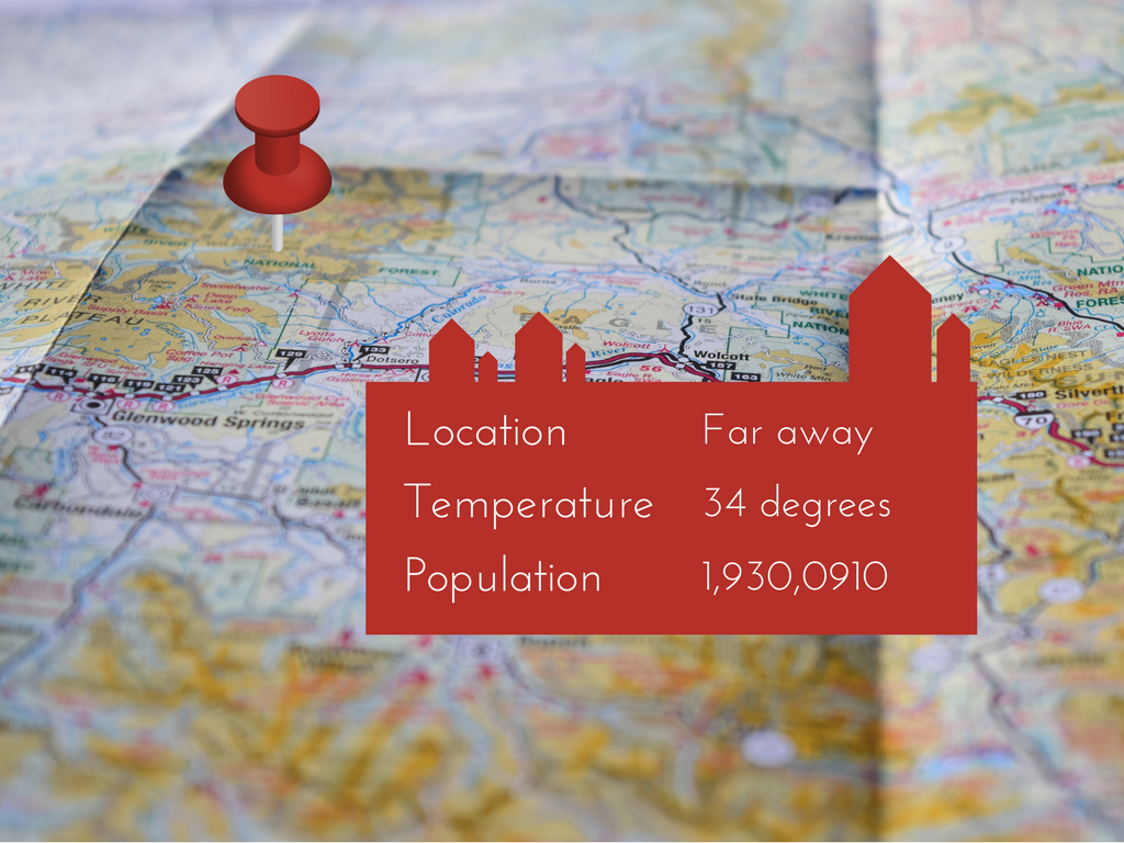
7. Address Geocoding
One of the most popular applications, used every day by thousands of people. We are referring of course on the application which allows us to find any address we want, or where a ZIP Code belongs etc. This application created through GIS system and the geocoding method which used an enormous database. In this database, coordinates are assigned with addresses and any other spatial information and when we search for an address the location appears on the map.
8. Reverse Geocoding
It is the reverse process of geocoding. Clicking on a map in a street address, GIS system shows the corresponding coordinates.
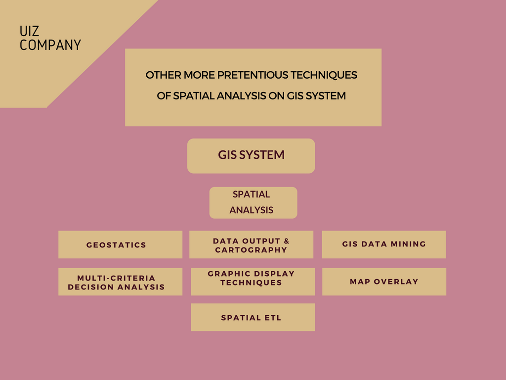
Other techniques we use on GIS system for spatial analysis
GIS system is one of the most significant tools, science provides for environmental upgrading and other field research. In this article we presented some very important methods we use on GIS system for spatial analysis and the corresponding applications in which they take place, to facilitate our research.
UIZ, a company with huge experience in GIS system, spatial analysis, and other research is available for your project or any information. To reach us call at +49-30-20679116 or visit our GIS system page on UIZ website.


