Use of GIS in Social Mapping Projects
Nowadays, the use of GIS in Social Mapping, Geographic Information System has increased notably and one of outstanding application is as a comprehensive tool for investigating geography and making intelligent decisions for social projects. GIS collects and distributes the data the way, that user reading a map could select data, which is required for a specific task or project. Normally, thematic maps have a table of contents that allows user to add several layers of information to the original map of the world. For example, social analysts can use baseman of a specific region and select different datasets to add to the data layer to a map to estimate education levels, ages, and employment status.
The ability to combine a variety of datasets in several ways makes GIS a useful tool in every field of knowledge. A decent GIS program is able to process data from a variety of sources and then implement it into a map project. Quite often data is freely available for public use in a lot of countries. Map file database often come included with GIS packages; it can either be ordered from the commercial organizations or from government agencies.
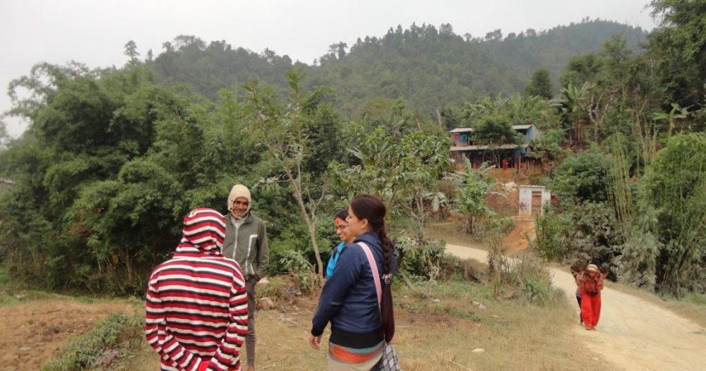
Picture showing use to social mapping for developing social infrastructure projects.
The application of geographic information system has become very widespread during the last decades. For many social projects maps produced from GIS data can be used to depict different relationships and significant correlations between geography and data investigated. Also, GIS maps are proved to be more user-friendly rather than other forms of presentations.
GIS can help plan, develop, implement and analyse different social program and policies. Whether to conduct a community requirements assessment or analyse service provision within a community, support some services, observe the impact, the benefits obtained by using GIS in a social project are apparent.
The capacity which GIS tool contains to construct data that is applicable to a large audience makes it a very valuable instrument for social workers. By utilizing this technology, social administrators can observe and evaluate new policies and researches. However, all of this is dependent on practitioners who is able to utilize and treat information and technology to enhance the practice and subsequently reporting the results of the activities.
Data is a central component in GIS technology and evidence-based output should also be produced such as data tables, graphs and reports. The future of GIS in social projects appears to be in the development of methods for even greater data sharing and distribution. The increase in the use of such technology has already been seen in different countries and institutions, particularly for example public health, social work, educational institutions and so on.
Additionally, the use of GIS allows user to create original digital maps using satellite transmissions, expands the use of GIS to remote areas which were not previously mapped and used for evaluation of different criteria, required for the project.
UIZ provides GIS service for a Social Mapping project. For further information please contact us: info@uizentrum.de and +49-30-20679115.


