What is WebGIS?
Before considering explaining the importance of WebGIS, you have to understand what this concept means.
Let’s see a simple explanation, WebGIS is a pattern, a designed method, from implementing a “contemporary” GIS. It is powered by web services that deliver data and abilities, and connect components.
- WebGIS is an alternative to the Desktop GIS, which offers you a lot of flexibility to work remotely, but most importantly gives you the chance to plan and be reactive to macro influences ( Demographical, Economical, Political, Ecological, Socio-Cultural, and Technological).
- WebGIS brings together data gathered throughout different ways (LiDAR, Drones, Sensor, Real-time, Social-Media, GPS, UAVs, Remote sensing, etc.) and using the proper technologies and tools (Internet of Things, Big Data, Smart Devices, Visualization, Consumerization, Cloud) is capable of developing applications ( mobile, 3D, Native, Real-time) that are then used for implementation in different environments to answer all kinds of questions and solve multiple hard-to-deal-with problems -So here comes its importance!
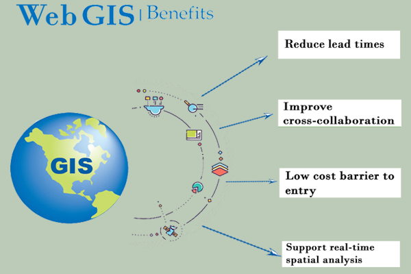
Why should you consider using WebGIS?
Simple! Here are some benefits to check out:
- Create maps and applications with the help of pre-defined templates or on your choice, on every field you can imagine connecting multiple structured data sources.
- A WebGIS provides businesses with the right tools to create insights and predictive modeling to support decision-making policies with the help of portals ( i.e. GoogleEarth, NOAA, USNG, OpenStreetMap and other national or local agencies and organizations).
- Access Web Maps from any device remotely is a very important benefit because the Web Maps are now available not only on desktop but on mobile phones and tablets which offers administrators wide flexibility in working with the data remotely and at the same time connections are easier to enable. And on top of that, it is time-saving!
- Publish and share multi-layer features and points on a single web map.
- Visualizing and editing the data has never been easier! You and your team can now edit and share single-layer or multi-layers with different departments depending on their role in the company. You can also publish layers on entire maps publicly or privately, depending on the content and purpose of the map or application.
- Support real-time spatial analysis.
- Unstructured data from sources like Four Instagram, Facebook, twitter etc, could be added up to the structured data, for support. Unstructured data can be called via the API which has been developed with REST / SOAP methodologies.
Do you want to hear some examples on how WebGIS can be used to improve your business or just to make your life easier? Just hear me out!
Let’s suppose that you, as a company, are interested in finding out where are the best places to take your team for a team-building, based on different aspects, such as distance from the home-city, traffic, noise, housing etc….
- WebGIS possesses some great tools to help you answer this question. There are a lot of national and international agencies, companies or even NGOs which provide you with all sorts of data which are imported in different GIS-based programs and processed with different tools will give you just the right answer that you are looking for.
Here is another one that could help you decide on whether or not to try this wonderful set of programs.
Let’s say that you have 2 hours free to roam around Bruxelles but you don’t know exactly where you could go, so it fits your schedule and is home in time. No problem !!
- You have ArcGIS Online to help you out. With some very basic setting, this online program is capable of generating a map that shows you exactly the area you can explore in 2 hours-time. You can also set to show you the areas you can explore in less than 2 hours. In case you change your mind or something comes up and it’s not possible to stay out longer. Isn’t it great?
Do you have a more complex project, like tracking and supervising the extinction of the bees or the level of groundwater in a specific area, in real-time ? There’s no problem?
- You have all the tools needed to successfully complete this task. You can use ArcGIS Pro and Python language to manage it. Is it true that you must know a little bit of programming language, but the output is way greater than the necessary input.
