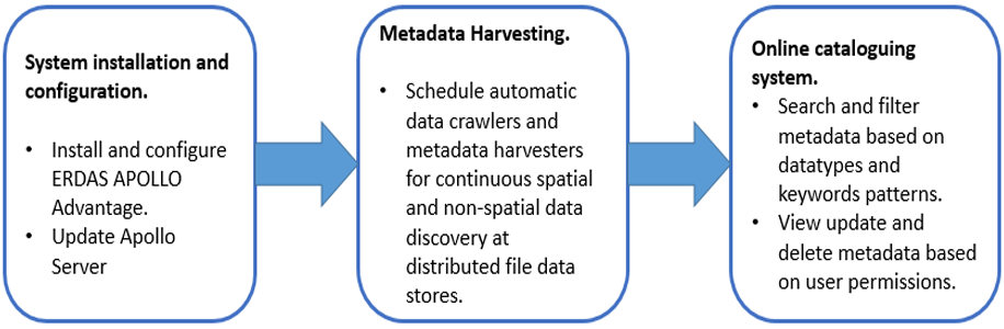
Metadata harvesting and online cataloging system preparation

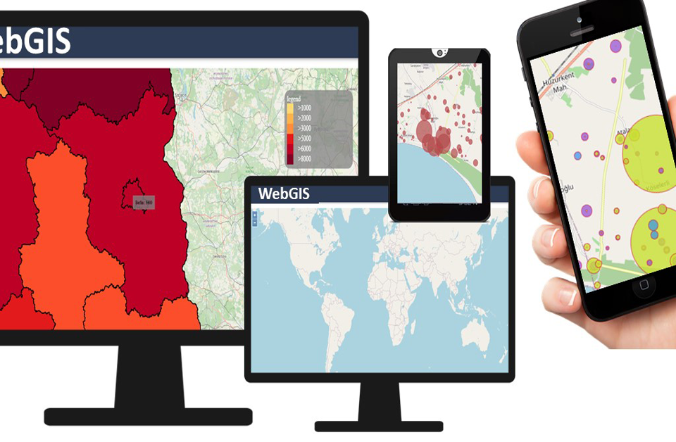
WebGIS platform-based query system preparation
September 10, 2020
Online data purchase mechanism preparation
September 10, 2020
A WebGIS platform for land use data dissemination combines the knowledge of complex GIS systems
with the standards and best practices of information technology to design and implement an end-toend system that deliver land use data services, tools and applications on the Web. We
describe the preparation of metadata harvesting and online cataloging system for the development of
a WebGIS solution-based land use data dissemination system.
Metadata harvesting and online cataloging system preparation
In the WebGIS platform development process is important the usage of an automatic metadata
management system to discover the semantics of a data element in data sets. Moreover, it is essential
to develop an online cataloging system to search, view, update and delete metadata.
a) Inputs/Data
• Metadata information.
• Spatial and non-spatial data.
b) Scope
• System development for instantaneous search and filter of metadata.
• User must be able to search according to the administrative boundary hierarchy.
• Interface should provide multiple options to choose from the toolbar windows.
c) Method
Metadata harvesting is the process of using automated tools to discover the semantics of a data
element in data sets. ERDAS APOLLO requires to be used to centralize metadata with scheduled
crawling and harvesting of regularly updated data holdings.ERDAS APOLLO facilitates powerful
workflows for describing, styling, securing, cataloging, and publishing spatial and non-spatial data in
the enterprise. After cataloging the data, users can then easily perform comprehensive searches on
the catalogue using powerful metadata and spatial search tools within the geospatial portal. ERDAS
APOLLO Advantage catalogs all the data, including vectors (GML, Shapefile, ESRI File
Geodatabase), and imagery in a single crawler. Metadata management for the project will support the
following data sets:
• Relational databases.
• Spreadsheets.
• XML files.
• Web services.
The online cataloging system as a Web solution will allow users to search, browse and publish the
data in data catalogue. It will also offer administration tools for the cataloging service. The cataloging
service will include a page to support in creating and submitting Catalog Service Web (CSW) requests
for authenticated users. It will utilize ERDAS APOLLO's implementation of the CSW-ebRIM profile
for searching catalogue and delivering metadata describing catalog holdings.
Users can search for and browse the public data in cataloging system without logging in. A user must
log in with a username and password to view private data, publish data, or use the administration
tools.
A user can filter his/her search based on specific data types. Several data type filters need to be
available to select. Some of the data type filters will include image datasets, vector datasets, and
datasets. While selecting image datasets from data type filters, the user will get only image datasets
information. Selecting datasets will return only images, vectors or documents.
Besides data type filters, filtering based on keywords and keyword patterns will also be available to
the users of Online Cataloging System. The keyword patterns are compared against the names,
descriptions and tags associated with the holdings in the catalogue. Keyword searches can be
combined using predicate operators like AND, OR etc.
When logged in as an authorized user, additional catalog record management links will be displayed
for each object in the search result. The authorized user will be able to delete and edit the catalogue
metadata of a service object and as well as the metadata of the layers associated to the service. Only
service objects (Web Coverage Service, Web Feature Service and Web Map Service) can be updated.
The solution will have full ISO 19115/19119/19139 support for resource and service metadata
management and encoding. Moreover, the administrator can perform batch metadata editing for
multiple datasets at once over an ISO 19115 metadata schema.
It is crucial that the cataloging service is based on Representational State Transfer (REST) software
architecture. Besides metadata management and cataloging, the system will also facilitate automatic
footprint, thumbnail and image pyramid generation for raster datasets. The proposed solution will
support the Relational Database Management Systems (RDBMSs) for cataloging:
• PostGreSQL 9 onwards.
The relational database system for management that emphasize in the extensibility feature and SQL
compliance.
• Microsoft SQL Server 2008.
Microsoft SQL is a database server, which may run either on the same computer or on another
computer across a network.
• Oracle 10G R2 onwards.
Oracle is a database for enterprise grid computing, Provides the best cost and flexibility to manage
information and applications.
d) Requirements
• Web based query system.
• ERDAS APOLLO Advantage.
• Relational Database Management Systems (RDBMSs).
• Computer Networking with internet connection.
e) Results
Automatic metadata harvesting and online cataloging system.
In conclusion, this article provides the process description of a WebGIS based land use data system
.
If you want to learn more about the development of a WebGIS-based land use system, we invite you
to read our previous article and our upcoming article in
its process workflow.
The “Umwelt und Informationstechnologie Zentrum” UIZ has many years of experience in the
development of WebGIS software. For more information or other services, please contact us.
Umwelt und Informationstechnologie Zentrum, UIZ GmbH Address: Karl-Liebknecht-Str. 34, 10178 Berlin
Phone: +49-30-20679115
E-mail: info@uizentrum.de
Web: www.uizentrum.de


