About the Service
Environmental monitoring is the continuous, automated observation of changes in the environment. UIZ inputs in this fields are countless, including the assistance in the development of powerful models, methods, and systems for the purpose of environmental monitoring, where some of them are now leaving the laboratory setting and others are founded implementation worldwide.
For environmental monitoring, UIZ offers help in installations of Remote Sensing tools and Photogrammetry because the information collected in this methods are the most confidential. Besides this, an advantage of the remote sensing method is the standardized data supply model, where UIZ teams can assist and coordinate its implementation.
Some clients require the remote sensing systems via satellites. We suggest the usage of this method when the location is extreme and the climate is not favorable. As an example, long-term monitoring of glacier requires satellite’s footages, digital satellite images and scanned aerial photographs in order to measure a rate of its melting which helps to set up a pre disaster forecasts.
UIZ invests a lot of its resources to contribute to the development of the modern remote sensing techniques, which will, in combination with suitable information management, be a key element for long-lasting environmental monitoring projects.
Process and Results
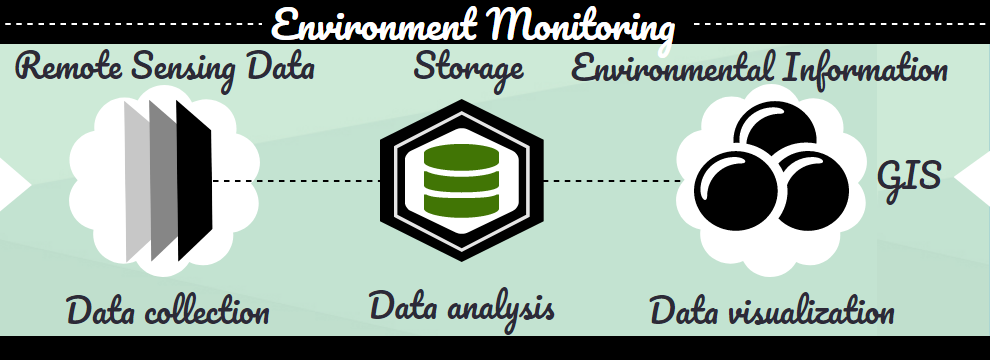
The environmental monitoring service that we are providing includes complete process, starting from data capture, data aggregation, data storage, data analysis and data visualization.
We help our customers on project implementation from many aspects including consulting service, expertise sharing, and coordination, on one side, while on the other side, we can offer our web-based GIS software, which purpose is to evaluate different environmental monitoring parameters.
Data collected by using some of the methods mentioned above are stored, aggregated in our GIS software, ready for further analysis. GIS has tools for data analysis, too. But the most powerful attribute of this software is rich data visualization techniques. UIZ’s GIS software implements techniques for different data, thermal, distance, deepness, 3D techniques to represent all dimension in nature, and many other.
UIZ is aware of the fact the outlook for our future is increasingly gloomy. This is the main fuel that powers UIZ’s engine developed to ensure sustainable futuristic methods.
For more information, please, !
