GIS & There Differences With Open Source GIS

GEO DATA STORING TYPES
April 9, 2018
The Process of Data Collection in GIS
April 24, 2018
What is GIS?
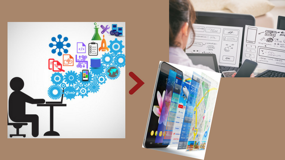
GIS is a leading software, becoming more and more famous every single day. And why that? Because it is applicable in every aspect of our everyday life. It is an amazing tool for cost-saving with great efficiency, for better decision making and record keeping, for improved communication and geographical management. So more specific, GIS is a software which allows us to stow, handle, analyze and visualize mainly geospatial data, but not only. And we refer to geospatial data because GIS gives the ability to relate every data with the location thus everything goes around the spatial information. For example, we may have data about hotels and through GIS we can place them in the right location. In that way, we create a geodatabase with all the hotels in every place and we can also visualize the result so the that to be more comprehensible and interactive. On the other hand, we may have data about the terrain slopes in an area. We can predict, measure and show on the map water flow and surface runoff depending on the corresponding slope. Another example could be schooled. We place the schools in the right location when digitizing the map. Furthermore, we can add information in a database such as the name of school, completeness, content of subjects etc. This capability is called an attribute table and is one of the biggest advantages of GIS, as it provides organized information. After that, it is not difficult to understand why GIS has taken so big popularity. However, GIS is not just that. The last years, it has been simplified and evolved to become accessible to everyone and to acquire more and more applications. Therefore, other software was developed in order to categorize all the applications of GIS, which now each of them include different tools and parameters depending on what we want to do. To make it clearer we will give an example. Open source GIS to serve users who use different software than windows, while WebGIS created in order to give the chance to anyone, to create maps and share data. Things that could not be done in the past through desktop GIS, now with all these subsections of GIS are just a game! Below in this article, we will see which are the differences between the conventional GIS and the open-source GIS.
What is Open Source GIS?
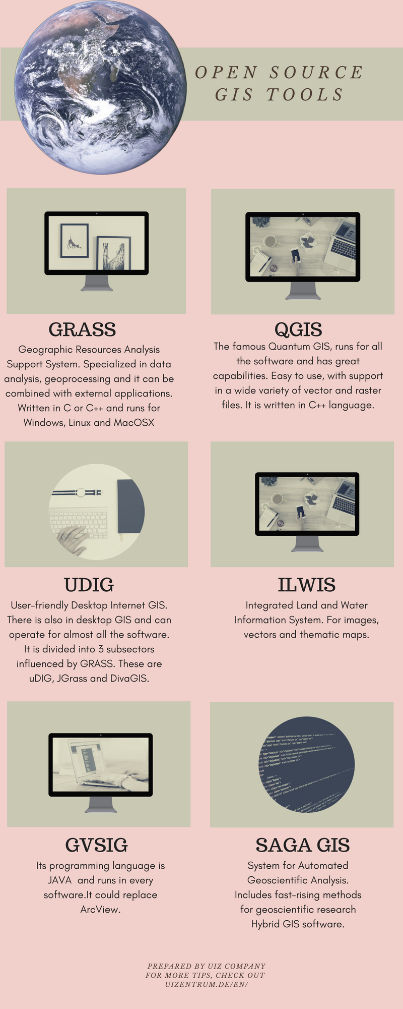
Now the thing becomes more complicated. Open source GIS is the free GIS software to which every wannabe programmer has access. You can really do anything there, from using geodatabases, to modify them or to create your own map. Simple till here! Open source GIS is operating in different programming languages from the conventional GIS, while WebGIS belongs in another category and it is not an open-source GIS. Three are the main categories of the programming language used by open source GIS as shown below:
-
- C language: The oldest and most famous technique as it provides coordinate reprojection which is very useful. From C language of open source GIS, created the GRASS application, as well as the Quantum GIS.
-
- JAVA language: Java gives the ability to tools and functions to compare the spatial data with the reality and extract as a result a true or false value, if the relation is questioned or not. Moreover, Java offers tools in open source GIS, such as “GeoTools”, “GeoServer” and “OpenMap”.
- NET language: Maybe the most important part, as it integrates every application operates with .NET in the open-source GIS. Some of them are “SharpMap” and “World Wind”
WebGIS and open source web mapping are two different categories.
Which are the Differences Between GIS and Open Source GIS?
It is really confusing when we refer to GIS and there are so many subcategories that we have to choose among, which one is the best solution for our needs. So, let’s explain the differences. First of all, we have to make it clear that conventional GIS has capabilities that no one of these subcategories has. Science is based on the conventional GIS to go further and not to open source GIS or WebGIS and that’s because the tools included in GIS are very technical and with a wide range of applications in many sciences. From that point started the creation of the subcategories as there was a need for simpler and easier to use tools and systems. This is the first and most important difference, because in conventional GIS we have the opportunity to create maps specialized for research and science, with details and calculations that only a professional can use and understand, and not only because we have some data and we want to reclaim them. Secondly, there is an issue with the specialists. When a tool is so useful and helps you in organizing even your house, everybody wants to know how to operate it. The big deal although, is that open source GIS operates in every software, while desktop GIS can be used only in Windows. So open-source GIS created for Mac and Linux users who couldn’t work on GIS, even if they run it in a virtualized environment because the product was very expensive to license. Whoever wants to learn WebGIS or open-source GIS, can do it but if he wants to learn conventional GIS need time, money and spiritual work. Money is another difference that shoves you in open source GIS.
UIZ Company undertakes projects and researchers related to GIS, open-source GIS and WebGIS. For more information, you can reach us at +49-30-20679130 or visit UIZ webpage to learn about our GIS services.


