GPS data collection in the mobile survey app

Benefits of working with the mobile data collection app
August 20, 2020
Development of a WebGIS platform-based land use data dissemination system
September 9, 2020
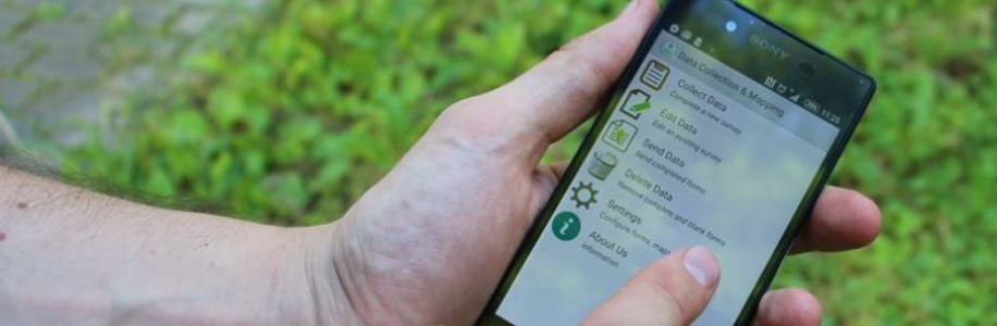
Our mobile survey app provides the facility to collect geographical information by providing a set of tools for visualizing, analyzing and manipulating data according to your project needs. This tool capture one or more points representing locations on Earth with the aim of supporting you with the understanding of your data for informed decision making, research, resources management, business, etc.
The GPS data collection in our mobile survey app is carried out by geopoint (GPS position), geotrace (drawing boundaries) and geoshape (tracing a path) information through questionnaires in order to visualize this data in a map. To visualize the data is necessary to create a location based form in which the app will record your location. If the data is collected in physical locations, the filled forms can be tracked and you can see in a map the progress of your project.
Geopoint data collection
The geopoint data collection can be used in three different ways and the output information will be the coordinates latitude and longitude. a. Geopoint data collection with no appearance. With this feature the application does not display a map to the user. b. Geopoint data collection with maps appearance. With this feature the application displays a map but it does not allow the user to place the point anywhere other than the device's current geolocation. c. Geopoint data collection with placement map appearance. With this feature the application helps the user get oriented in the selection of any point from a map. To collect the data the user should press long to place the point in the desire location.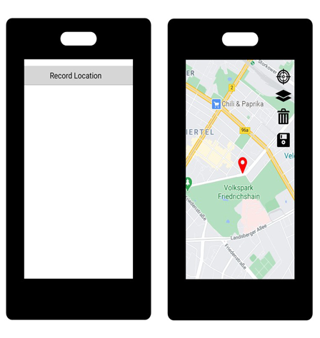
GeoTrace data collection
With the geoTrace data collection you will collect a series of points that together will form a line. For example a river, a path, a road, etc. The points can be entered either by tapping the screen to place each point, or by automatically collecting points along a line every few seconds. The three location recording modes are: a. Geotrace data collection by tapping the place. With this feature the user needs to tap the map in the device to place locations. b. Geotrace data collection by manually recording the location With this feature the user chooses the moment when a point should be record by pressing the button at the top of the screen. c. Geotrace data collection by automatically recording the location With this feature the user needs to select a recording interval and accuracy requirement.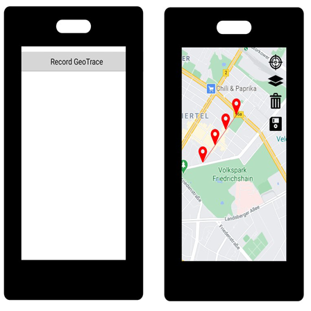
GeoShape data collection
The geoshape data collection will collect data on an area, such as the outline of a house, a company, a farm or a land, etc. The collected points will form a closed polygon. The points can be entered either by tapping the screen to place each point, or by automatically collecting points along a line every few seconds. The three location recording modes are: a. Geoshape data collection by tapping the place. With this feature, the user needs to tap the map in the device to place locations. b. Geoshape data collection by manually recording the location With this feature the user chooses the moment when a point should be recorded by pressing the button at the top of the screen. c. Geoshape data collection by automatically recording the location With this feature the user needs to select a recording interval and accuracy requirement.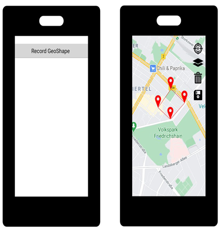
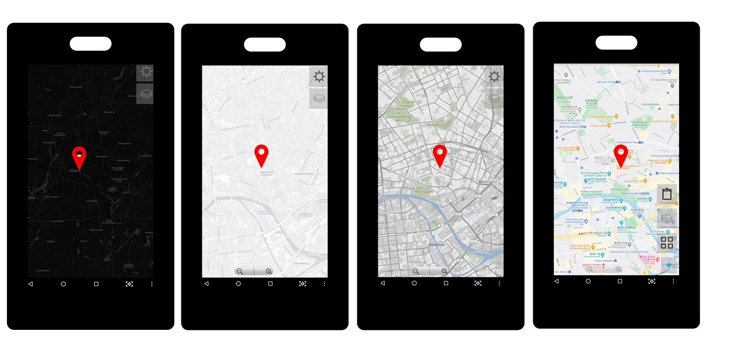
Map appearance in the survey app
There are different map appearances in the survey app, this default basemaps are listed below.
• Default
• Google Maps Satellite
• Street Classic
• Outdoors
• Dark
• Activities
Offline maps for GPS data collection.
To visualize an offline map in the app, you will need to create a MBTiles file. Once the MTBtiles file is created you need to place the file in the app folder of your device. MBTiles files contain raster or vector tilesets that specifies the zoom levels range in which they are visible.
What is an example of how you can use your mobile survey app?
For example, every year, vaccination campaigns are launched in developing and underdeveloped countries. These campaigns can be supported with personnel using mobiles devices in which the mobile survey app is running to provide accurate and fast reports on the vaccine coverage.
This article provides information of the GPS data collection techniques in the mobile survey app developed by UIZ. With years of experience, professional and specialized staff, “Umwelt und Informationstechnologie Zentrum” UIZ GmbH provides you information and support to your project in the field of data collection.
Umwelt und Informationstechnologie Zentrum, UIZ GmbH Address: Karl-Liebknecht-Str. 34, 10178 Berlin
Phone: +49-30-20679115
E-mail: [email protected]
Web: www.uizentrum.de


